Eye in the Sky: Landmark US-India Satellite Captures Dramatic Time-Lapse of Volcanic Eruption, Unlocking Next Era in Hazard Prediction
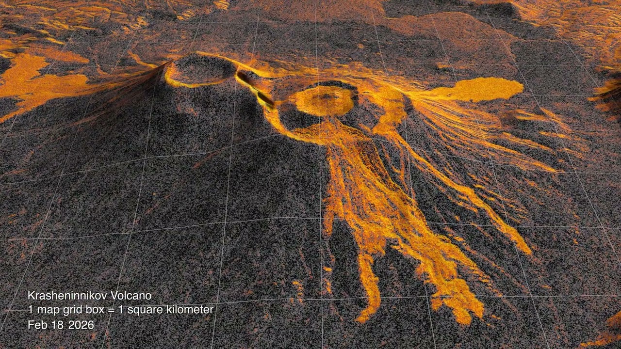
PASADENA, Calif. & NEW DELHI — In a profound technological and diplomatic milestone, a state-of-the-art joint space initiative between the United States and India has achieved an unprecedented scientific breakthrough: capturing a granular, high-resolution time-lapse sequence of an active volcanic eruption from low Earth orbit. Released by NASA’s Jet Propulsion Laboratory (JPL) in Southern California, the imagery strips away smoke, ash plumes, and cloud cover to reveal millimetric ground shifts and dynamic lava movements in real time.
The time-lapse data—produced by the collaborative orbital radar architecture developed by NASA and the Indian Space Research Organisation (ISRO)—marks a major leap forward in planetary observation. By transforming static satellite snapshots into a fluid, temporal chronicle of subterranean geological violence, the mission delivers critical operational intelligence to disaster mitigation agencies, commercial aviation networks, and geophysicists worldwide.
Cracking the Ash Curtain: How Radar Pierced Volcanic Fury
Traditional optical satellites routinely struggle when tracking active volcanoes. Dense clouds of sulfur dioxide, ash plumes soaring miles into the stratosphere, and local meteorological cover frequently blind orbital cameras at the most critical moments of an eruption. The US-India satellite circumvented these physical limitations by deploying advanced Synthetic Aperture Radar (SAR) systems capable of cutting through atmospheric particulate matter day or night.
By compiling repeating radar scans over consistent intervals, scientists at NASA JPL and ISRO stitched together an extraordinary time-lapse sequence. The footage depicts the rapid mechanical deformation of the volcano’s caldera, documenting the physical inflation of the mountain as magma surged toward the crust, followed by catastrophic structural collapse and the subsequent trajectory of lava channels carving through surrounding topography.
“This is not merely a visual achievement; it represents a fundamental paradigm shift in how we monitor active geohazards,” said a senior research scientist associated with the JPL radar team. “We are no longer looking at the aftermath of an eruption. We are watching the Earth's crust breathe, buckle, and rupture on a dynamic timeline. The implications for civil protection and early warning alerts are profound.”
Executive Briefing: The Strategic & Scientific Takeaways
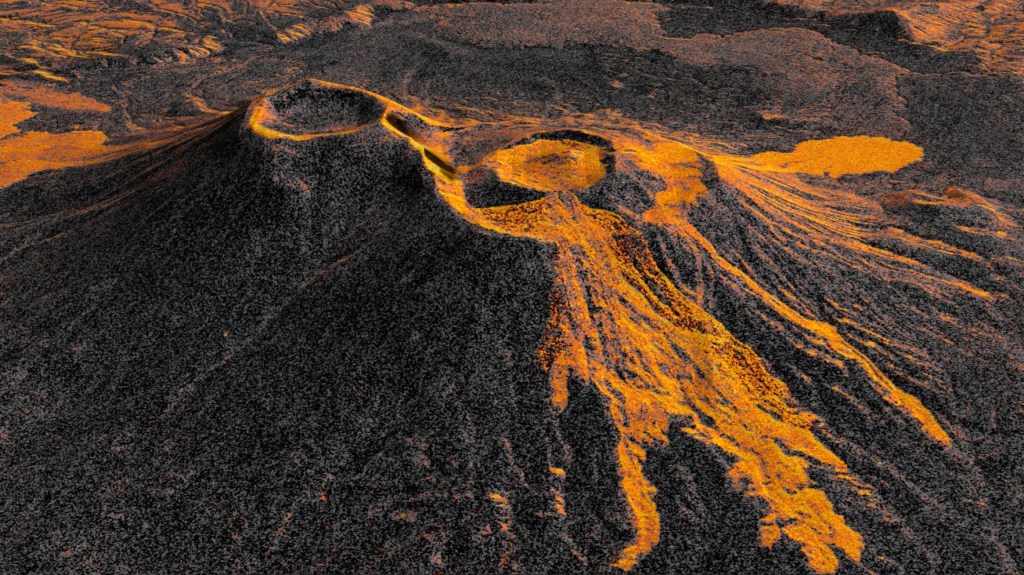
- Unprecedented Visibility: Utilizes dual-frequency Synthetic Aperture Radar (L-band and S-band) to pierce ash clouds and atmospheric obscurity, rendering millimetric surface changes visible over days and weeks.
- Predictive Evacuation Windows: Precise deformation tracking allows vulcanologists to detect ground swelling—a direct indicator of magma ascent—days before surface venting begins, vastly expanding public safety evacuation timelines.
- Aviation Risk Mitigation: Volcanic ash clouds inflict billions of dollars in damage on turbine engines and cause widespread flight cancellations. Real-time time-lapse data provides predictive modeling for ash disbursement and air corridor diversions.
- Deepening US-India Tech Alignment: The NASA-ISRO partnership solidifies the broader initiative on Critical and Emerging Technology (iCET) spearheaded by Washington and New Delhi, setting a new benchmark for cross-border scientific investments.
Economic and Logistical Consequences for Global Commerce
Beyond its geodynamic brilliance, the data addresses severe economic vulnerabilities. Volcanic events routinely paralyze global trade corridors. The 2010 eruption of Iceland’s Eyjafjallajökull, for instance, grounded over 100,000 flights and wiped an estimated $5 billion from global gross domestic product. By deploying consistent orbital radar time-lapses, civil aviation authorities gain access to immediate velocity metrics regarding explosive venting and ground collapse.
Furthermore, maritime logistics and critical infrastructure operators—often positioned along coastal tectonic belts such as the Pacific "Ring of Fire"—can utilize the temporal data to stress-test supply chains, port facilities, and fiber-optic landing stations exposed to secondary threats like tsunamis and pyroclastic flows.
Technical Specifications: The US-India Earth Observation Apparatus
The operational framework behind this achievement represents one of the most sophisticated engineering programs undertaken between the two nations, combining American radar instrumentation with Indian launch integration and complementary sensor payloads.
| Metric / Parameter | System Specification | Strategic Relevance |
|---|---|---|
| Sensor Architecture | Dual-Frequency L-Band & S-Band Radar | Penetrates heavy ash, dense forest canopies, and cloud cover |
| Deformation Sensitivity | Sub-Centimeter (Fractions of an inch) | Measures pre-eruption magma reservoir swelling |
| Temporal Revisit Frequency | 12-Day Systematic Orbital Cycle | Constructs fluid time-lapse timelines of moving landmasses |
| Operating Consortium | NASA JPL (USA) / ISRO (India) | Flagship scientific asset under bilateral civil space pacts |
| Primary Data Access | Open Science / Global Public Domain | Empowers international humanitarian and disaster agencies |
Geopolitical Implications: A New Era for NASA-ISRO Ties
For New Delhi and Washington, this milestone offers undeniable diplomatic validation. What began decades ago as cautious civil space dialogue has rapidly matured into an indispensable operational alliance. As both nations deepen their industrial coordination through high-tech initiatives, the JPL-ISRO space partnership stands as the physical manifestation of shared technological sovereignty.
Senior Indian space officials emphasized that the data pipeline generated by the system will be shared openly with regional disaster risk platforms throughout Southeast Asia and the Indian Ocean rim. This democratized access counters traditional data monopolization, providing developing economies with access to world-class disaster surveillance without requiring prohibitive domestic capital outlays.
Future Outlook: Predictive Earth Science
As the joint team refines its automated time-lapse algorithms, the next objective is integrating artificial intelligence models directly with ground-station downlinks. The goal: autonomous early-warning triggers that flag subterranean magmatic shifts before human analysts can even review the telemetry. In an increasingly volatile climate punctuated by high-risk tectonic zones, the US-India orbital sentinel is proving that the future of disaster prevention lies in watching Earth’s time unfold from the stars.
Frequently Asked Questions
Why is a time-lapse video from space so significant for volcanic monitoring?
Volcanic activity unfolds across varying time horizons—gradual ground swelling takes weeks, while explosive eruptions happen in minutes. Traditional satellites only deliver disconnected, static images that often miss sudden structural changes or get blocked by ash. Synthetic Aperture Radar time-lapse sequences provide a continuous, multi-dimensional view of structural changes and lava flows beneath atmospheric cover, enabling scientists to observe the entire lifecycle of an eruption with millimetric accuracy.
How does this US-India collaboration benefit global emergency response?
Because the radar data is cataloged across systematic orbital tracks and processed under open-science frameworks, emergency management teams globally can access actionable maps of land shifts, impending caldera collapses, and lava trajectories. This operational intelligence allows governments to order proactive civilian evacuations, reroute commercial air traffic ahead of catastrophic ash plumes, and protect critical supply chain infrastructure before surface eruptions peak.