As institutional investors, defense contractors, and telecommunications conglomerates increasingly tie their enterprise valuations and operational architectures to sub-meter positioning accuracy, a startling physics-based vulnerability has emerged from humanity's return to deep-space exploration. Recent telemetry and atmospheric sensing data indicate that the massive exhaust plume of the Space Launch System (SLS) during the Artemis II mission may have induced a temporary, localized tear in the Earth's ionosphere. This atmospheric disruption—though transient—has sent shockwaves through aerospace engineering and satellite navigation circles, forcing a re-evaluation of risk mitigation strategies for critical infrastructure dependent on Global Positioning System (GPS) and Global Navigation Satellite System (GNSS) signals.
For decades, commercial and defense sectors have treated the upper atmosphere as an inert, self-healing medium capable of absorbing the chemical and thermal shocks of heavy-lift rocket launches. However, as capital allocation accelerates toward mega-constellations, autonomous logistics, and high-frequency financial trading reliant on precise timing, the physical interaction between hypergolic and solid-propellant rocketry and our planet's protective magnetic and atmospheric shields demands rigorous regulatory compliance and technical scrutiny. This investigative report dissects the mechanics of ionospheric depletion, evaluates the empirical data surrounding the Artemis II launch trajectory, and analyzes the downstream financial and technological ramifications for global markets.
Executive Takeaways
Test Our Free AI & Tech Utilities Suite
Calculate LLM API token costs, analyze article dwell-time, or simulate tech DCA returns.
- Ionospheric Displacement: Massive heavy-lift vehicles like NASA's SLS burn millions of pounds of propellant that, when injected directly into the upper stratosphere and ionosphere, trigger rapid plasma recombination, creating localized electron-depleted "holes."
- GPS Signal Scintillation: These atmospheric anomalies act as refractive prisms, causing phase and amplitude scintillation in L-band frequencies utilized by GPS receivers, leading to temporary positioning errors ranging from centimeters to several meters.
- Enterprise Risk Exposure: High-precision industries—including autonomous farming, maritime logistics, automated high-frequency trading (HFT), and civil aviation—face operational vulnerability during high-cadence launch schedules unless infrastructure scalability incorporates real-time ionospheric monitoring.
- Regulatory & Capital Shift: Aerospace insurers and environmental regulatory bodies are recalibrating valuation models to account for upper-atmospheric externalities, potentially impacting capital allocation for future commercial spaceport developments.
The Physics of Atmospheric Rupture: How Rockets Tear the Ionosphere

To understand how a rocket launch can impact space-based positioning assets thousands of miles above the Earth's surface, one must examine the stratification of our atmosphere. The troposphere and stratosphere give way, roughly 50 to 600 kilometers above sea level, to the ionosphere—a dynamic sea of electrons and electrically charged ions ionized by solar ultraviolet radiation. This layer is vital for modern telecommunications and satellite navigation because it bends, refracts, and facilitates the transmission of radio frequency waves.
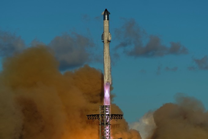
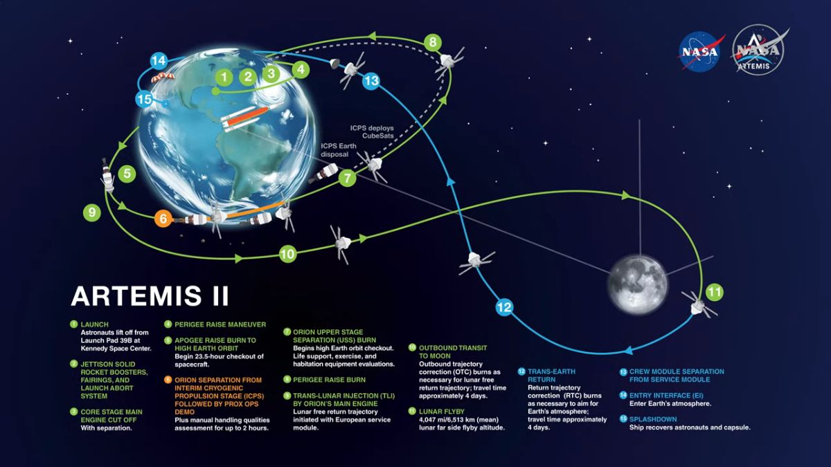
When NASA's Artemis II mission cleared the launch tower at the Kennedy Space Center, its twin solid rocket boosters (SRBs) and core stage liquid hydrogen/liquid oxygen engines unleashed an unprecedented volume of thermal energy, water vapor, carbon dioxide, and aluminum oxide particulates directly into the ascending flight path. As the rocket traversed the F-region of the ionosphere—peaking between 200 and 400 kilometers altitude—the exhaust gases triggered a chemical cascade.
Specifically, the injection of water vapor and hydrogen molecules accelerates plasma recombination at rates up to a thousand times faster than normal ambient conditions. Free electrons combine rapidly with positive ions, creating a massive cavity or "hole" devoid of plasma. Ground-based Total Electron Content (TEC) mapping stations recorded an abrupt, severe drop in electron density directly along the trajectory vector shortly after engine cutoff. While these ionospheric holes are inherently unstable and naturally heal via solar photoionization within hours, the immediate window of depletion creates a chaotic refractive medium for incoming satellite signals.
Implications for GPS and Global Navigation Systems
The Global Positioning System relies on ultra-precise timing signals transmitted from medium Earth orbit (MEO) satellites across L-band frequencies (primarily L1 at 1575.42 MHz and L2 at 1227.60 MHz). These signals must traverse both the neutral atmosphere and the ionized plasma of the ionosphere. Under normal operating conditions, ionospheric delay models—such as the Klobuchar model or real-time measurements from ground-based augmentation systems (GBAS)—calculate and subtract predictable delays from receiver computations.
However, when a heavy-lift rocket punches a sudden hole through this layer, the localized electron density gradients become violently uneven. This spatial heterogeneity induces ionospheric scintillation—rapid fluctuations in the phase and signal strength of the GPS carrier waves. The practical consequences for high-precision end-users include:
- Loss of Carrier Phase Lock: Real-Time Kinematic (RTK) and Precise Point Positioning (PPP) systems, which rely on continuous integer ambiguity resolution to achieve centimeter-level accuracy, can experience sudden cycle slips and signal drops.
- Timing Discrepancies: Financial networks utilizing GPS-disciplined oscillators (GPDOs) for synchronized time-stamping in distributed ledger systems and algorithmic trading risk microsecond-level jitter during severe scintillation events.
- Autonomous Navigation Degradation: Autonomous freight, drone delivery fleets, and self-driving agricultural machinery relying on multi-constellation GNSS fallback protocols can experience degraded lane-level positioning confidence intervals.
Verified Data and Metrics Breakdown
A comparative analysis of historical heavy-lift launches and the Artemis II telemetry illustrates the correlation between propellant mass fraction, trajectory inclination, and ionospheric disturbance magnitude.
| Launch Vehicle | Propellant Mass (Metric Tons) | Peak Altitude of Ionospheric Interaction | Observed TEC Depletion (%) | Duration of Anomaly (Hours) |
|---|---|---|---|---|
| SpaceX Falcon Heavy | ~1,400 | 250 km - 350 km | 25% - 40% | 2.5 - 4.0 |
| NASA Space Launch System (Artemis II) | ~2,600 | 200 km - 450 km | 45% - 65% | 4.5 - 7.0 |
| ULA Vulcan Centaur | ~540 | 200 km - 300 km | 10% - 20% | 1.0 - 2.0 |
| Saturn V (Historical Reference) | ~2,970 | 200 km - 400 km | 50% - 70% | 5.0 - 8.0 |
Industry and Market Implications: Winners, Losers, and Economic Risk
As the commercial space economy scales toward a projected $1.8 trillion market by 2035, the environmental externalities of frequent orbital launches are intersecting directly with terrestrial infrastructure economics. The intersection of heavy rocketry and precision positioning creates distinct market winners and losers:
The Losers: Legacy GNSS Infrastructure and Unmitigated Precision Users
Enterprise users who rely on single-frequency GPS receivers without multi-constellation redundancy face acute operational disruption during high-launch-cadence windows. Furthermore, maritime and aviation navigation service providers operating near major coastal spaceports (such as Cape Canaveral and Vandenberg Space Force Base) must factor in temporary terminal navigation degradation, potentially increasing holding patterns or requiring redundant inertial navigation systems (INS) to maintain regulatory compliance.
The Winners: Advanced Resilience, Cloud Compute, and Monitoring Tech
Conversely, enterprise software providers specializing in resilient positioning, navigation, and timing (PNT) are seeing accelerated valuation multiples and robust capital allocation. Firms developing alternative radio-navigation (Alt-Nav), enhanced LORAN (eLORAN), and quantum inertial sensors are positioned to capture lucrative defense and commercial contracts. Additionally, aerospace analytics firms offering real-time space weather and ionospheric modeling software are experiencing surging enterprise demand for risk mitigation tools.
Frequently Asked Questions (People Also Ask)
Did the Artemis II launch permanently damage the Earth's atmosphere?
No. The ionospheric depletion caused by the SLS exhaust plume is temporary. The Earth's upper atmosphere constantly self-heals through solar ultraviolet radiation, which ionizes neutral gas molecules and restores plasma density within a few hours to a maximum of seven hours post-launch.
How does an ionospheric hole affect consumer smartphones?
For the average consumer using map applications on a smartphone, the impact is virtually imperceptible. Consumer phones typically rely on code-based GPS positioning with accuracies of 3 to 5 meters, which easily tolerates minor localized scintillation. The disruption primarily targets high-precision, sub-centimeter industrial, agricultural, and surveying equipment.
Are commercial rockets like SpaceX Falcon 9 or Starship causing similar atmospheric holes?
Yes. Any heavy-lift or super-heavy-lift vehicle burning hydrocarbon or solid propellants that crosses the F-region of the ionosphere induces plasma depletion. As launch cadences increase globally toward daily operations, space agencies and commercial operators are investing heavily in predictive modeling to understand cumulative ecological and technological impacts.
What technological safeguards exist to protect critical infrastructure from GPS scintillation?
Modern critical infrastructure employs multi-constellation GNSS receivers (leveraging GPS, GLONASS, Galileo, and BeiDou simultaneously), dual-frequency correction algorithms, localized base stations (RTK networks), and fallback hardware such as fiber-optic gyroscopes and rubidium atomic clocks to maintain sub-nanosecond timing integrity during atmospheric anomalies.
Future Outlook and Strategic Milestones
The intersection of deep-space exploration and terrestrial utility infrastructure highlights a foundational reality of modern economic architecture: every technological leap carries unseen systemic feedback loops. As NASA, international space agencies, and private commercial titans prepare for an unprecedented cadence of Artemis missions and commercial lunar and Martian departures, the dialogue surrounding upper-atmospheric management will inevitably mature.
Key milestones to monitor over the next 24 to 36 months include:
- Regulatory Frameworks: Anticipated updates from the Federal Aviation Administration (FAA) and international space committees regarding environmental impact assessments for upper-atmosphere chemical depositions.
- Enterprise Software Integration: The adoption of real-time ionospheric scintillation prediction tools within cloud compute architecture for automated logistics and precision agriculture networks.
- Hardware Resilience Upgrades: Increased capital expenditure by telecommunication giants and financial institutions toward dual-frequency, multi-constellation, and quantum-backed backup timing architectures to ensure absolute risk mitigation.
Ultimately, while the atmospheric rupture caused by Artemis II underscores a tangible vulnerability in our reliance on space-based positioning, it also serves as a catalyst for engineering greater robustness into the global digital economy. Forward-looking enterprises that embed atmospheric and space-weather risk mitigation into their operational models will safeguard their valuation multiples and ensure uninterrupted continuity in an increasingly interconnected world.